Tokyo (28 February 2024) - Mitsubishi Research Institute, Inc. (MRI) and New Space Intelligence, Inc. (NSI) have begun work on new services using NSI's Satellite Data Pipeline for customers in Japan and overseas. The services bring advanced satellite-based monitoring to a wider audience, with potential uses ranging from infrastructure maintenance and disaster prevention to international business.
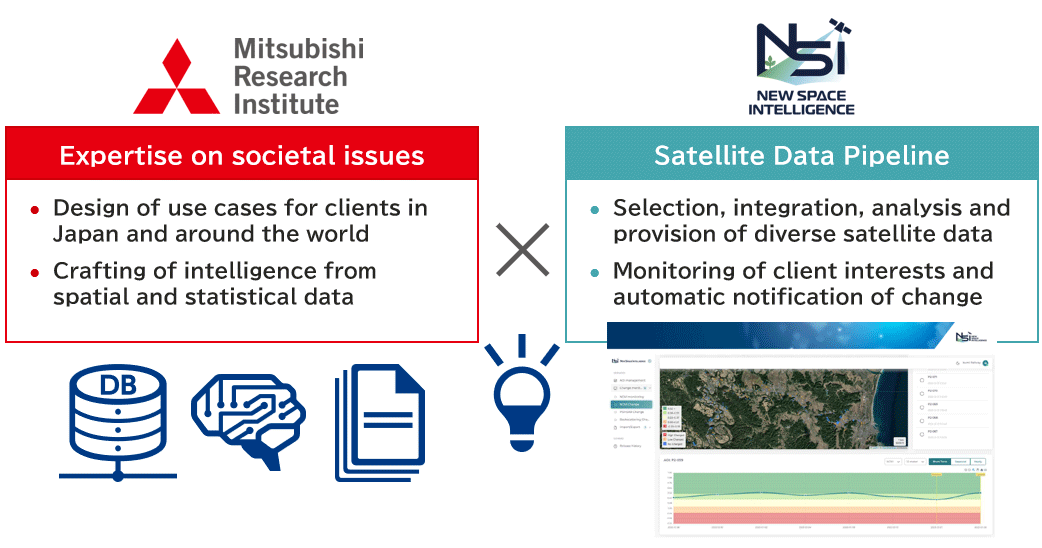
The roles of each in the new satellite intelligence services

MRI had been conducting research and studies to demonstrate the potential of satellite data for use across society. NSI’s unique technology caught their eye, and both companies began collaborating, with MRI eventually investing in NSI.
“As the world is overcome with uncertainty, it’s crucial that we make decisions based on objective evidence,” says Masanori Muto, project manager at MRI. “We are working with NSI on new services that combine satellite, spatial, and statistical data for intelligence. This makes it possible to take a peek at what’s going on halfway around the globe, whether that’s monitoring infrastructure, assets, or the business environment. We are already getting new partners in on the service.”
The number of satellites in low earth orbit have ballooned in recent years, and the imagery they gather is attracting attention for its potential uses. But satellite data remains relatively expensive and requires expertise and time for proper analysis. As the amount of available satellite data grows, quality curation will become another necessity for users.
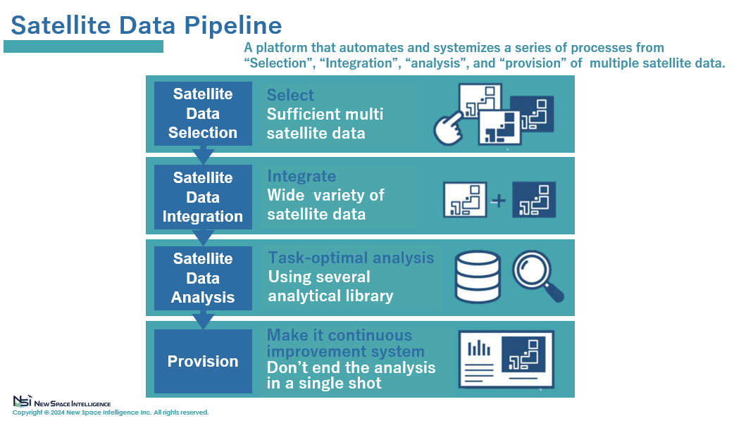
“Our technology addresses the issues facing satellite data use,” says Yumiko Nagai, CEO of NSI. “It automates a series of processes spanning image selection, integration, analysis, and provision of data. In other words, it’s a pipeline for data from multiple satellites. And wide-area, regularly-collected data like this can be useful in a variety of cases. For example, it can help officials identify warning signs for the early detection of disasters. This would make society safer and more resilient.”
With the need for intelligence based on spatial information such as satellite data growing, MRI estimates the market-size would grow at 10 trillion yen worldwide.
About the Satellite Data Pipeline
The Satellite Data Pipeline is a platform service that combines data from multiple satellites and automates a series processes spanning image selection, integration, analysis, and data provision. The result is high-frequency, wide-area surface monitoring built on optimal data for a low cost. Users are automatically notified of any changes, such as a natural disaster, that occur across assets and infrastructure monitored by the service.
The Satellite Data Pipeline is a platform service that combines data from multiple satellites and automates a series processes spanning image selection, integration, analysis, and data provision. The result is high-frequency, wide-area surface monitoring built on optimal data for a low cost. Users are automatically notified of any changes, such as a natural disaster, that occur across assets and infrastructure monitored by the service.
Overview of the Satellite Data Pipeline

Source: NSI
